


ID :
251912
Thu, 08/16/2012 - 16:42
Auther :
Shortlink :
http://m.oananews.org//node/251912
The shortlink copeid
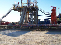
Turkmenistan conducts geodynamic monitoring at oil and gas pipeline sections
Turkmenistan, Ashgabat, Aug. 15 / Trend H.Hasanov /
Scientists of the Institute of Seismology of the Academy of Sciences of Turkmenistan are conducting geodynamic monitoring in areas of laying of oil and gas pipelines, the Neutral Turkmenistan newspaper reports.
The article says that this type of monitoring involves, first of all, seismic monitoring over manifestations of natural and man-made seismic, geodetic observations of vertical and horizontal shifts in the surface deposits, geophysical (gravimetric, geomagnetic, geoelectric) observations of the internal state of the field and hydrogeological, hydrogeochemical and operational.
The Institute is also developing a new general seismic zoning map of the entire country.
"For the first time for Turkmenistan fixation of all the vast array of input and output data will be implemented in digital electronic format of geographic information system (GIS). Thanks to all this, maps and applications for them can be easily represented graphically in any projection, and at any scale," the article said.
In the field of earthquake engineering, the study of seismic characteristics of soils, local seismic effects of construction sites and identification of natural resonant frequencies of oscillations of "skyscrapers" and "site-effects" of building sites by studying the seismic noise of natural origin, which is new for Turkmenistan, but proven by international practices, will be conducted.
By request of the Ministry of Construction the Institute of Seismology finalized four regulations, as well as developed "Standardized Toolkit for radiometric studies in construction."
For the first time for Turkmenistan method of using of electrical research, GPR profiling, records of microseismic oscillations and shallow seismic survey in complex of engineering-geological surveys was proposed and tested.
Among the main activities of the Institute is the improvement of geophysical monitoring of seismogenic zones in the territory of Turkmenistan. In this direction eight methods have already been prepared for the introduction.
Turkmenistan is currently experiencing a construction boom, across the country architectural complexes, most of them are tall, are built, and these are houses, government agencies, educational institutions and shopping centers.
The Caspian country is located in a seismically hazardous area. On the night of October 6, 1948, Ashgabat suffered a catastrophic earthquake, whose strength measured 10 and claimed many lives.
The country is characterized by the presence of structurally unstable soils of the grounds, and because of the climatic conditions the high corrosiveness is observed.
The high salinity of groundwater, the intensity of solar radiation and other environmental factors distinguish the problem of corrosion protection of the facilities and are the subject of scientific research institute of earthquake engineering in Ashgabat.